Drone Incursions at Wildfires Hit Record 74 in 2026
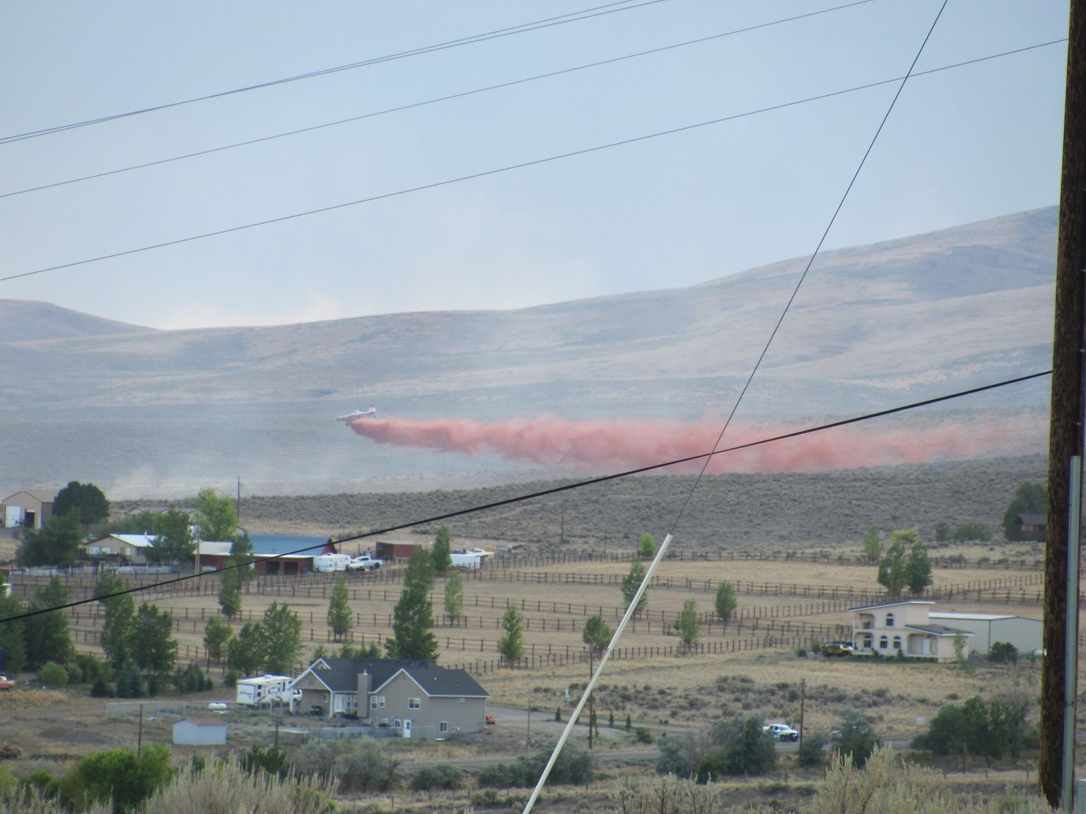
Civilian drones flew into active wildfire airspace 74 times in 2026 through September 1, up from 53 incursions in 2025 and 32 in 2024, according to data the U.S. Wildland Fire Service shared with DroneLife. The incursions forced firefighting aircraft to divert 78% of the time, grounding water and retardant drops at the moment fire crews needed air support most.
Background
A temporary flight restriction (TFR) is airspace the FAA closes to all aircraft except those directly fighting a fire or supporting the incident — a rule explained in full in PickDrones' guide to drone no-fly zones. Flying a drone into an active wildfire TFR is a federal crime, not a paperwork violation: it puts low-flying water tankers and helicopters, which already operate with minimal margin for error, on a collision course with an aircraft nobody is tracking.
The U.S. Wildland Fire Service (WFS) defines an incursion as "a non-participating UAS operating over or near an incident that intrudes into an area with a temporary flight restriction or interferes with incident/mission operations." The agency compiles incursion counts from the interagency Aviation Safety Communiqué and the SafeCom incident database, which aggregates reports from the Interior Department, the USDA Forest Service, and state firefighting agencies.
The Data: Incursions More Than Doubled Since 2024
| Year | Wildfire drone incursions | Aircraft diverted |
|---|---|---|
| 2024 | 32 | — |
| 2025 | 53 | — |
| 2026 (through Sept. 1) | 74 | 78% of incidents |
Washington state accounted for 45 of the 74 incursions recorded in 2026 — by far the most of any state — followed by California with 7. Brad Koeckeritz, division chief of the WFS Uncrewed Aircraft Systems Division, told DroneLife the spike tracks a specific pattern: fires that burn into the wildland-urban interface, where dense population puts more camera-equipped drones within reach of the fire line. "When you have more people, the probability of somebody having a drone increases," Koeckeritz said.
Washington's numbers reflect that pattern directly. The Autumn Lane, Fairview, and Old Trails fires near Spokane burned into neighborhoods on the city's edge in August 2026, and PickDrones previously reported that drones entered that restricted airspace at least 26 times in three days, grounding retardant-dropping aircraft and triggering an FBI task force response. That single cluster of fires alone accounts for a meaningful share of the state's 2026 total.
Enforcement: Fines Up to $75,000 and License Revocation
Flying into a wildfire TFR exposes a pilot to penalties far beyond a warning. The FAA can pursue criminal charges carrying up to two years in prison, civil fines reaching $75,000 for operations that endanger aircraft or people, and suspension or revocation of a pilot's Part 107 certificate — the commercial drone license covered in PickDrones' FAA Part 107 guide. Recreational flyers without a certificate are not exempt; the TFR applies to every drone in the airspace regardless of the operator's license status.
The WFS runs a year-round public education campaign, "If you fly, we can't," aimed at hobbyists who may not realize a wildfire TFR exists over their neighborhood until they check an aviation chart or an app like B4UFLY. Koeckeritz said the agency's practical message is blunt: a grounded water tanker cannot make its next drop while a drone operator gets footage for social media.
Repeated incidents have pushed some jurisdictions beyond citations into active interdiction. In Spokane, the response escalated to an FBI task force actively working to force unauthorized drones out of fire airspace in real time, rather than relying solely on after-the-fact citations. A June 29, 2026 incident near Beaver, Utah, logged in the SafeCom database, shows the same pattern repeating in smaller, less-populated fires far from any major city — incursions are not confined to large urban-interface blazes.
What This Means for Drone Pilots
Any TFR — fire, VIP movement, stadium event, or disaster response — carries the same legal weight regardless of whether the pilot is flying commercially or for fun, and regardless of the drone's weight or price. Before flying anywhere near a reported wildfire, check the FAA's TFR list or an airspace app for an active restriction; a fire's smoke plume being visible from miles away is itself a strong signal that restricted airspace exists nearby. Outside the US, the same principle holds under different names — EASA states, the UK CAA, and CASA in Australia all issue equivalent temporary restrictions around active wildfires, and ignorance of a local NOTAM is not a defense anywhere.
The trend also raises the stakes for drone-as-first-responder and inspection programs that rely on sharing airspace safely with crewed aircraft, an issue PickDrones has tracked as Skydio and other operators push autonomous dock-based drones into first-responder missions in similar emergency airspace.
FAQ
Sources: DroneLife | U.S. Wildland Fire Service — No Drone Zone
More like this
Related Articles
FAA Awards $12M for BVLOS Drone Test Research (2026)
The FAA gave $12 million to 19 BVLOS drone research projects on October 5, 2026, as its Part 108 rule sits stalled in White House…
Germany Backs Ukraine With $9.6B Drone Interceptor Deal
Germany and Ukraine signed 15 defense deals worth over $9.6B on Oct. 4, funding mass production of jet-powered interceptor drones…

Wing, Walmart Drone Delivery Hits Denver, Seattle in 2027
Wing and Walmart will launch drone delivery in Denver and Seattle in 2027, expanding toward 270 Walmart stores and 40 million US c…