How to Make Money with Drones: 10 Real Ways (2026)
The pattern repeats itself constantly: someone buys a drone to photograph their backyard from above, document a vacation, explore the hobby. A few weeks later, the requests start arriving. A friend wants wedding footage. A neighbor asks about roof inspection. The local real estate agency wants aerial shots of a listing. Suddenly, the $1,500 drone is paying for itself - and then some.
This path from hobby to income is more common than most new pilots expect. The commercial drone services market has grown steadily across every major economy, driven by falling hardware costs, better software tools, and genuine demand from real estate, construction, agriculture, energy, and media sectors. The question isn't whether the market exists - it does - but which segment makes sense for your skills, equipment, and location.
This guide covers ten concrete ways to generate income with a drone, with realistic pricing and the certifications required in the main markets.
The global commercial drone market
Before diving into specific services, the broader picture matters. Global commercial drone services are expected to exceed $58 billion annually by 2030, up from roughly $14 billion in 2024 - a compound annual growth rate of around 20%.
Every major market shows the same dynamic: drone hardware prices have fallen dramatically while the applications have multiplied. Equipment that cost $10,000 five years ago now costs $2,000. This means operators compete less on "I have a drone" and more on "I have the skill and certification to deploy it professionally."
Certification requirements by country:
| Country | Regulatory body | Commercial license | Key requirement |
|---|---|---|---|
| United States | FAA | Part 107 Remote Pilot Certificate | Written test, no flight test |
| United Kingdom | CAA | GVC (General VLOS Certificate) | Ground school + practical assessment |
| Australia | CASA | RPC (Remote Pilot Licence) | CASA-approved training + knowledge test |
| European Union | EASA | A2 CofC or STS authorization | Theory exam + self-declaration or full authorization |
| Canada | Transport Canada | RPAS Pilot Certificate - Advanced | Ground school + flight review |
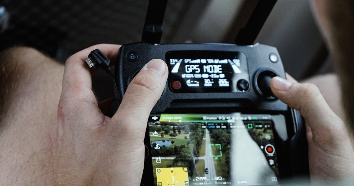
In all these markets, the certification is what separates a hobbyist from someone who can legally accept payment for drone services. Without it, clients can't verify your insurance, can't put your name on a contract, and won't hire you for anything beyond a casual favor.
1. Event photography and videography
The most common entry point - and for a clear reason. Weddings, corporate events, sports competitions, festivals, and graduations represent the most accessible market for new commercial pilots.
The visual difference is obvious: aerial footage transforms an event record. A ceremony filmed from 50 meters has an aesthetic that ground-level shooting simply can't match. Couples, families, and companies pay for that difference.
What you need to start:
- A drone with a 3-axis gimbal stabilized camera - the DJI Air 3 or Mini 4 Pro are solid entry points
- Video editing skills (DaVinci Resolve, Premiere Pro, or similar)
- Your country's commercial pilot certification
- Third-party liability insurance (legally required in most markets)
What to charge:
| Market | Wedding drone services | Event coverage |
|---|---|---|
| United States | $500–$2,500 | $400–$1,500 |
| United Kingdom | £350–£2,000 | £300–£1,200 |
| Australia | AUD 600–3,000 | AUD 500–1,800 |
| EU (avg.) | EUR 400–1,800 | EUR 300–1,200 |
The limitation of this segment is seasonality: concentrated on weekends, with peaks at certain times of year. Most successful operators use events as one revenue stream among several.
2. Real estate and property photography
The real estate industry was one of the first to adopt drones at scale. Properties marketed with aerial photography sell faster - and in competitive markets, often at higher prices.
The work includes:
- Exterior aerial photography of homes and commercial properties
- Progress documentation of construction projects
- Aerial video for property listings and development presentations
- Establishing shots that show location, neighborhood context, and surroundings
What to charge:
| Market | Residential property | Commercial/development |
|---|---|---|
| United States | $200–$600 | $800–$3,000 |
| United Kingdom | £150–£450 | £500–£2,000 |
| Australia | AUD 300–700 | AUD 800–3,000 |
| EU (avg.) | EUR 200–500 | EUR 600–2,000 |
The key to building income from real estate is recurring relationships, not one-off jobs. Three or four agencies with consistent listing activity can provide predictable weekly work without constant prospecting.
3. Roof and structural inspection
Less glamorous than photography, but economically more resilient. Demand for drone inspection is growing in insurance companies, construction firms, property management companies, and industrial facilities.
The business case is straightforward: a drone inspection of a roof is safer than scaffolding (eliminates fall risk), faster (hours instead of days), and more thoroughly documented (complete photographic record of every surface). Insurers in particular have adopted drones as a standard post-claim inspection tool.
Services most in demand:
- Residential and industrial roofs - tile condition, waterproofing, gutters
- Building facades - cracks, water infiltration, deterioration mapping
- Vertical structures - antennas, chimneys, silos, cooling towers
- Power line infrastructure - routine tower and cable inspection
- Solar farms - identifying defective panels using thermal imaging
Thermal cameras add significant value here. Thermal payloads can identify active water infiltration and failed solar panels that RGB cameras miss. The equipment investment is higher - thermal cameras or payloads add $3,000–$15,000 to the cost - but energy sector and insurance contracts pay proportionally more.
What to charge:
| Service type | US | UK | Australia |
|---|---|---|---|
| Residential roof inspection | $200–$600 | £150–£400 | AUD 300–700 |
| Industrial/infrastructure | $1,500–$10,000 | £1,000–£7,000 | AUD 2,000–12,000 |
4. Aerial mapping and photogrammetry
Photogrammetry converts sequential aerial photographs into 3D models, orthomosaics, elevation data, and georeferenced point clouds. It's the segment with the highest per-project value and the fastest professional growth rate.
Clients include civil engineers, surveyors, architects, municipalities, mining companies, and construction firms that need:
- Topographic surveys - replacing traditional ground survey methods
- Construction progress tracking - volumetric measurement of earthworks and build progress
- Land mapping - precise boundary and terrain documentation
- Orthophoto mosaics - high-resolution aerial maps for urban and rural planning
The differentiator that separates this segment from photography is the software workflow. Tools like Pix4D, DroneDeploy, Agisoft Metashape, and DJI Terra process the captured images and generate the final deliverables: 3D models, contour lines, volume calculations, GIS-ready data. Mastering the complete workflow - flight planning, capture, processing, and report delivery - is what makes contracts worth significant money.
What to charge:
| Project scope | US | UK | Australia |
|---|---|---|---|
| Small area survey (1–5 acres) | $500–$2,000 | £400–£1,500 | AUD 700–2,500 |
| Medium mapping (50–200 acres) | $2,000–$10,000 | £1,500–£8,000 | AUD 3,000–12,000 |
| Monthly construction monitoring | $1,500–$6,000/month | £1,200–£4,500/month | AUD 2,000–7,000/month |
5. Agriculture and precision farming
Agriculture is the fastest-growing commercial drone sector by revenue in nearly every major farming economy. In the US, Australia, and EU, agricultural drone services have moved from pilot programs to standard practice in large-scale operations.
Opportunities for service providers include:
- Crop monitoring - periodic flights with multispectral cameras to detect water stress, pest pressure, and nutrient deficiencies via NDVI/NDRE indices
- Soil variability mapping - for variable-rate application of inputs
- Spray application - with agricultural drones like the DJI Agras T50 or XAG P100
- Seeding and granule spreading - increasingly common in rice paddies (Asia, Australia), cover crop applications (US, EU)
Spraying requires the largest capital investment - agricultural spray drones cost $30,000–$80,000 - but generates the highest per-hectare revenue. For operators without that capital, multispectral monitoring with a mid-range drone is a viable and highly profitable entry point.
What to charge:
| Service | US | UK/EU | Australia |
|---|---|---|---|
| Crop monitoring per hectare | $3–$12 | €4–€15 | AUD 5–$18 |
| Spray application per hectare | $15–$35 | €18–€45 | AUD 20–50 |
The agricultural market is strongly regional - pricing, crop types, and client sophistication vary significantly between the Corn Belt and California, between Andalusia and the Netherlands, between Queensland and Victoria.
6. Content creation for brands and agencies
Marketing agencies, media companies, and brands with active social media presences are a growing market for skilled drone operators. The service goes beyond flying: it involves scene direction, framing decisions, and delivering edited or semi-produced material ready for publication.
Most-requested formats:
- Short-form video (Reels, TikTok) featuring aerial shots of venues, events, or products
- Advertising campaigns with aerial coverage of brand locations or properties
- Corporate video for companies showcasing their facilities or operations
- YouTube content for creators who need specific aerial shots for their productions
Day rates for brand and agency work vary significantly by market and production scale:
| Market | Day rate |
|---|---|
| United States | $1,000–$5,000 |
| United Kingdom | £700–£3,500 |
| Australia | AUD 1,200–$4,500 |
| EU (avg.) | EUR 800–3,000 |
7. Training and flight instruction
Every new drone sold is a potential student. With the proliferation of equipment and the expansion of commercial operations, demand for pilot training consistently outpaces the supply of qualified instructors.
The market divides into two types:
Recreational training: lessons for hobbyists who want to learn to fly safely. Can be in-person or online. Rates vary from $100–$300/hour for in-person instruction in most markets.
Commercial certification prep: preparing candidates for their country's commercial pilot test - Part 107 in the US, GVC in the UK, RPC in Australia, A2 CofC or STS in the EU. Ground schools and instructors charge $300–$1,500 for complete prep packages.
The challenge is credibility: students want to learn from someone with real-world experience and a documented portfolio. Building that track record as an operator first is the most common path to viable instruction work.
8. Live streaming and broadcast
Drones with low-latency video links are used by event producers, broadcasters, and streaming platforms for live aerial coverage.
Highest-demand events:
- Outdoor sports - cycling, motorsport, sailing, off-road racing
- Music festivals and concerts - aerial views during performances
- News and journalism - aerial coverage of public events and breaking news
- Real estate launches - live aerial walkthrough of a development site
The equipment requirements go beyond a standard drone: low-latency video transmission systems (DJI O4 or professional solutions like Teradek or LiveU), and usually coordination with the event's production team to integrate the signal into the existing broadcast chain.
This segment is smaller in volume but pays higher day rates. In the US and UK, broadcast drone work can command $2,000–$8,000/day including the operator. Specialist insurance and operating authorizations (flying near crowds typically requires a specific exemption) add to the overhead but also justify the higher rates.
9. Environmental monitoring and research
Research institutions, environmental NGOs, universities, and government agencies (EPA, Environment Agency UK, CASA, European Environment Agency) commission drone operators for environmental monitoring. Common applications:
- Deforestation and fire monitoring - aerial documentation of forest areas for enforcement
- Wildlife census - aerial counting of animals in reserves and protected areas
- Vegetation mapping - using multispectral cameras to assess ecosystem health
- Coastal and waterway monitoring - tracking erosion, pollution, and habitat change
This segment typically requires long-term contracts via tender or grant processes, rather than direct client prospecting. The cycle is slower, but contracts are more stable - funded by international environmental programs, national governments, or large NGOs. Day rates can be competitive with corporate work, but budget timing is less predictable.
10. Equipment rental
Not every professional needs to own a high-end drone for occasional use. Insurance adjusters doing a specific inspection, production companies with a one-off project, photographers who need a model more advanced than they own - all are potential rental clients.
The model can be:
- Wet hire (with operator): you bring the drone, fly it, deliver the output. Most common in most markets.
- Dry hire (drone only): you rent the aircraft to a licensed pilot. Requires verifying the renter's certification - both legally and for insurance purposes.
What to charge:
| Drone type | US/day | UK/day | Australia/day |
|---|---|---|---|
| Consumer prosumer (DJI Air 3) | $300–$800 | £200–£600 | AUD 400–900 |
| Professional (DJI Mavic 3 Pro) | $600–$1,500 | £400–£1,000 | AUD 800–1,800 |
| Specialist (thermal/LiDAR payload) | $1,500–$4,000 | £1,000–£2,500 | AUD 2,000–5,000 |
What you need to start (and what it costs)
Investment requirements vary by segment, but here's a realistic overview of the minimum viable setup:
| Segment | Primary equipment | Total estimated investment |
|---|---|---|
| Events & photography | DJI Air 3 | $3,500–$5,000 |
| Real estate & inspection | DJI Mavic 3 Pro | $5,000–$8,000 |
| Mapping with RTK | DJI Mavic 3 Enterprise or Phantom 4 RTK | $12,000–$25,000 |
| Agriculture (monitoring) | DJI Mavic 3 Multispectral | $12,000–$18,000 |
| Agriculture (spray) | DJI Agras T50 | $55,000–$80,000 |
Beyond hardware, fixed costs apply across all segments:
- Certification (required for commercial ops): $100–$600 depending on country and training route
- Insurance: $500–$1,500/year for commercial liability coverage
- Extra batteries: minimum 3 per aircraft for any professional job
- Business registration: required for regular paid work in all countries
What you can realistically earn
The variance is significant, but market data gives a calibration point:
- Occasional operator (1–2 days/month): $800–$2,500/month
- Part-time operator (4–6 days/month): $3,000–$7,000/month
- Full-time operator with structured client base: $7,000–$22,000/month
- Specialized firm with team and multi-aircraft fleet: six-figure annual contracts are achievable
The biggest differentiator between the lower and upper ends isn't equipment - it's specialization. Operators who master a specific niche, like thermal inspection of solar farms or photogrammetric surveys for civil engineering, earn more, face less direct competition, and build long-term relationships with high-value clients.
The mistakes that end careers before they start
Operating without certification. In every major market, accepting commercial payment without the appropriate certification is illegal and exposes you to fines, civil liability without insurance coverage, and in serious incidents, criminal charges. Check your country's requirements before your first paid job.
Pricing your equipment, not your results. Clients don't buy flight hours. They buy images, reports, data, and decisions. Operators who price by flight time lose to those who price by deliverable and value created.
Underestimating post-flight work. The flight is 20% of the job. Editing, photogrammetric processing, report generation, on-time delivery - that's what clients pay for. Underestimating this part leads to impossible schedules and unsatisfied clients.
Trying to serve all segments at once. The temptation to say yes to every job type results in inadequate equipment for half the work and a diffuse reputation. Choose one or two segments, master them, build portfolio and references - then expand.
Flying without insurance. A drone landing on a car, a person injured by a falling aircraft, equipment lost inside private property - any of these incidents can generate costs that far exceed the drone's value. Liability insurance is what separates the professional from the amateur when something goes wrong.
FAQ
Sources: FAA - Become a Drone Pilot | UK CAA - Operators & pilots | CASA Australia - Commercial drone operations | EASA - Drone operators | Transport Canada - RPAS
More like this
Related Articles
Best Drones for Remote Workers & Office Creators (2026)
Best drones for remote workers in 2026: compact, sub-249g picks for content creators and digital nomads who film from home, the of…
UK CAA Drone Rules 2026: IDs, Fees, and Fines Explained
UK drone rules changed on January 1, 2026: registration now kicks in at 100g, not 250g. Full Flyer ID, Operator ID, A2 CofC, and f…
EASA Drone Categories: Open, Specific, Certified (2026)
EASA splits every EU drone flight into Open, Specific, or Certified. Here's which category you're in, which C-class you need, and…